Project of six (6) reservoirs, within the framework of the Basic Master Plan for Storm Drainage developed by ACUMAR. Engineering works (dams, dumps, orifices, discharge channels, sewers, etc.), including detailed Topography and Geotechnical works. Preparation of the bidding documentation for the construction of the works. The proposal of these works dates back to the first studies in this basin, carried out by EIH in the mid-80s, in order to determine the Water Regime and later identify the works necessary for Flood Control, which resulted in a scheme consisting of reservoirs in the upper and middle basin and pumping stations in the lower basin, complemented by pipelines and defense works.
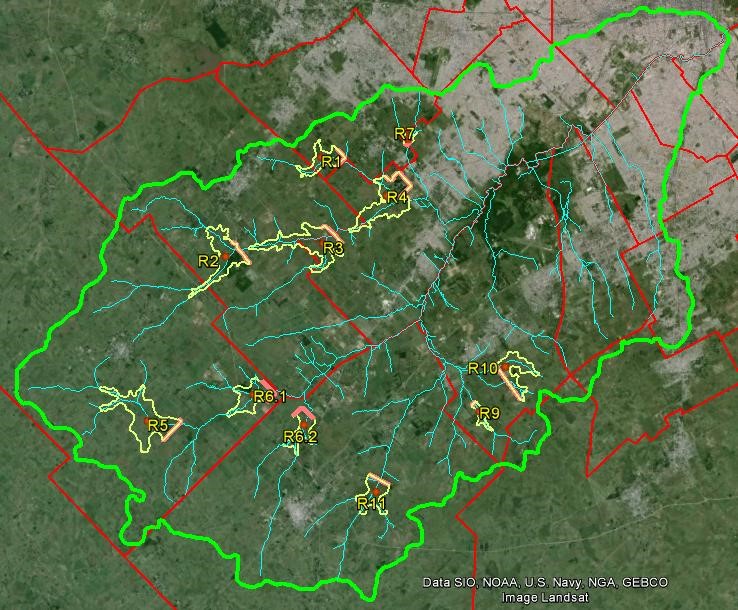
For the control of floods in the Matanza – Riachuelo basin, with a surface area of 2,238 km2, a series of Temporary Retention Areas for Water Surplus has been planned in its upper and middle parts. The work included the Geotechnical, Topography and Engineering studies necessary to carry out the six (6) reservoir project; framing it within the Basic Master Plan for Storm Drainage developed by ACUMAR. The reservoirs studied are identified as R01; R02; R04; R07; R09 and R10.
The technical project documentation necessary for the Client to be able to bid comprehensively for the construction of each of these works was prepared.
- R01. Dam length: 2,662 m, Max. Height: 8.60 m, Weir Length: 10 m, Bottom river mouth: 2xΦ 1.00 m
- R02. Dam length: 3,480 m, Max. Height: 7.90 m, Weir Length: 75 m, Bottom river mouth: 2xΦ 2.00 m
- R04. Dam length: 3,756 m, Max. Height: 7.90 m, Weir Length: 100 m, Bottom river mouth: 4xΦ 1.20 m
- R07. Dam length: 1,319 m, Max. Height: 5.70 m, Weir length: 10 m, Bottom river mouth: 2xΦ 1.00 m
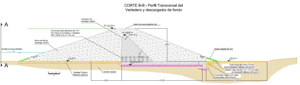
- R09. Dam length: 830 m, Max. Height: 4.45 m, Weir Length: 20 m, Bottom river mouth: 3xΦ 1.00 m
- R10. Dam length: 5,163 m, Max. Height: 5.20 m, Weir Length: 10 m, Bottom river mouth: 4xΦ 1.00 m
The work carried out included
- Geotechnical Surveys (1,600 m. Of boreholes, 700 m. Of holes and 200 m. Of excavations for pits).
- Topographic surveys of the basin, alignment of the closure and discharge works areas (26,000 topographic points distributed over 5,500 hectares, 41 fixed points).
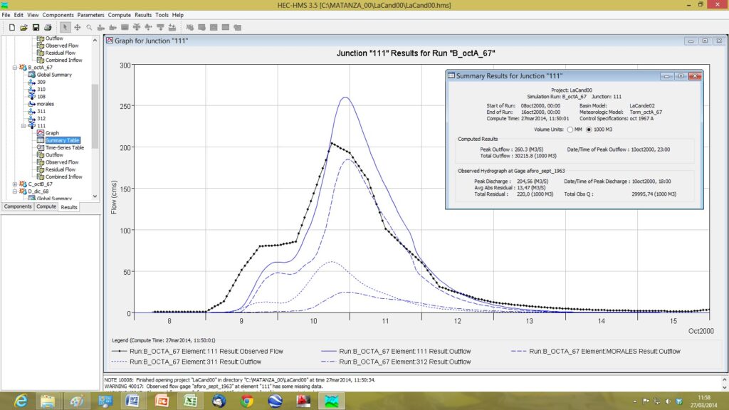
- Hydrological studies and Mathematical Modeling of the basins and the behavior of the reservoirs and their discharge works (orifices and weirs).
- Hydraulic studies and models of channels, reservoirs and discharge works.
- Structural calculation.
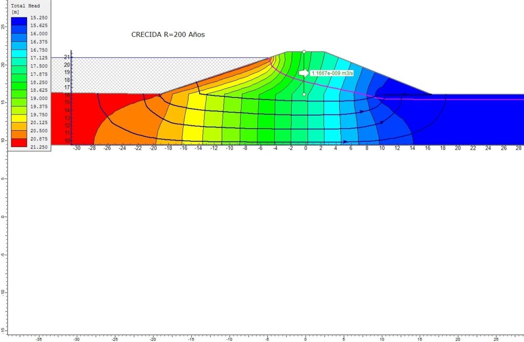
- Geotechnical studies, foundations and stability.
- Project of closing embankments (dams), hydraulic discharge works, restoration works to the river, road works, monitoring systems.
- Cadastral study on 800 parcels.
- Metric calculation and budget.
- Technical specifications.
It should be noted that prior to this work, in the mid-1980s, EIH began studies of the Matanza – Riachuelo basin with a multidisciplinary framework, the objective of which was to determine the water regime and propose solutions for flooding in the basin. The defined works, consisted of 11 reservoir dams in the middle and upper basins and 13 pumping stations in the lower basin, were brought to the advanced Preliminary Project level. With the passage of time and the anthropic modifications of the basin, particularly regarding the occupation of the territory, it was necessary to reformulate the projects in new implantation sites, which led to the project of the six (6) reservoirs carried out in last instance.